Description
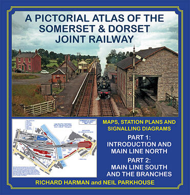
A fresh new look at the Somerset & Dorset Railway, which, by means of detailed maps, follows the main line from Bath Green Park to Broadstone Junction. The journey on to Bournemouth West, on L&SWR/SR metals, is then included, after which we travel along the branches, from Evercreech Junction to Burnham-on-Sea (the original main line), Wells and Bridgwater. There are track plans and signalling diagrams for every location, all in colour. The maps are enlivened by a superb range of 1950s and ‘60s colour slides, picture postcards issued between the early 1900s and 1930, and early 19th century photographs, the majority of which have never been published before. As well as the stations passed along the way, time is also taken to study the industries and collieries the S&D served, plus the Company’s Works and wharf at Highbridge. Together, these two volumes present a comprehensive picture of a much-loved cross-country railway which sadly is now just a memory.
468 pages. 275x275mm. Two volumes printed on gloss art paper with colour laminated board covers, presented in a colour laminated board slip case. These books books weigh 4 kilos and will be sent out via a courier.